The southeast corner of Arizona is a special place. In case you’re not familiar with it, cities such as Benson, Tombstone, Wilcox, Bisbee, Douglas, Huachuca City (est. in 1877 as Camp Huachuca) and Sierra Vista are in that region. This is the part of Arizona where I grew up. Some of the land is just like what you see in those old western movies about Cowboys and Indians: seemingly dry, flat and grassy with mesquite, palo verde, creosote bush, cactus and the occasional hill or arroyo. The parts of southeast Arizona you never saw in those movies are called the Sky Islands.
The term Sky Island refers to an isolated mountain range which is surrounded by lowlands with a markedly different ecosystem. This means that a temperate forest environment on the mountain can be in close proximity to a tropical or desert-like environment in the lowland. Both the Chiricahuas (peak elevation 9760 ft.) and the Dragoons (peak elevation 7520 ft.) are Madrean Sky Islands and were a sort of “cradle of civilization” in the southwestern U.S. There is archaeological evidence of Apaches living in the Chiricahuas as early as the 14th century.
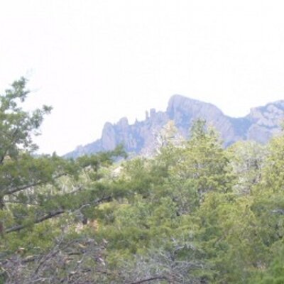
The photo you see above is a picture of a geological formation called Cochise Head in the Chiricahua Mountains of southeastern Arizona. It is said to resemble Cochise’ face gazing up at the sky.
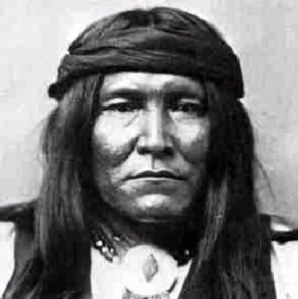
Cochise
Chief Cochise (K’uu-ch’ish) was the leader of the Chiricahua Apaches from around 1850 until his death in 1874. The estimates of his birth year span from 1804-1825. I think he was probably born in 1806 in southern Arizona – in the region that was later known as the Gadsden Purchase. A Fire Tiger year would fit him because of his fame and his skill as a strategist. Cochise had a reputation as a great leader and although he was captured (and escaped), he was never defeated in battle.
Did you know the name Cochise means “having the qualities of oak”? I think his name has to do with the evergreen kind of oak and Cochise’ gift of survival. Oak is a very hard wood. Perhaps his biggest strength was his knowledge of the land where he grew up.
The Gadsden Purchase
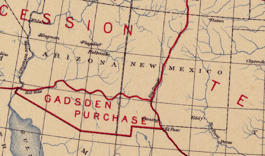
In 1853 James Gadsden, U.S. Ambassador to Mexico, was sent by President Franklin Pierce to make a treaty with General Antonio Santa Anna, President of Mexico, in order to extend the southern border of the U.S. The goal was to secure land for a southern railroad route to the west coast. Without a railroad, travel through the area was slow and hazardous due to the desert environment and Apache raids.
The original intention of Gadsden was to buy land as far south as Guaymas, Mexico but the Congress did not support that idea and Mexico wasn’t falling for that.
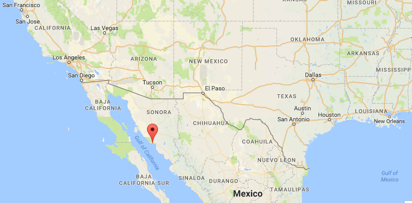
The marker on the map is Guaymas, Mexico.
I see this as a huge failure for Gadsden. Can you imagine the difference it would have made to the character and development of Arizona to have a coastline and access to the state via water? For one thing, the capital of Arizona would probably have been a port city rather than landlocked Phoenix which was purposely chosen for its central location.
The treaty was signed on December 30, 1853: a Metal Rat day in a Water Rat month in a Water Ox year. This elemental lineup of water, metal and earth does not bode well for a Fire Tiger like Cochise. The conflicts, kidnappings and killings that had already been underway would only get more intense for him and his people.
The U.S. paid $10 million dollars for a 29,670 square mile portion of Mexico which would later become part of the states of Arizona and New Mexico. The treaty was ratified by the Senate on June 24, 1854.
Texas Canyon
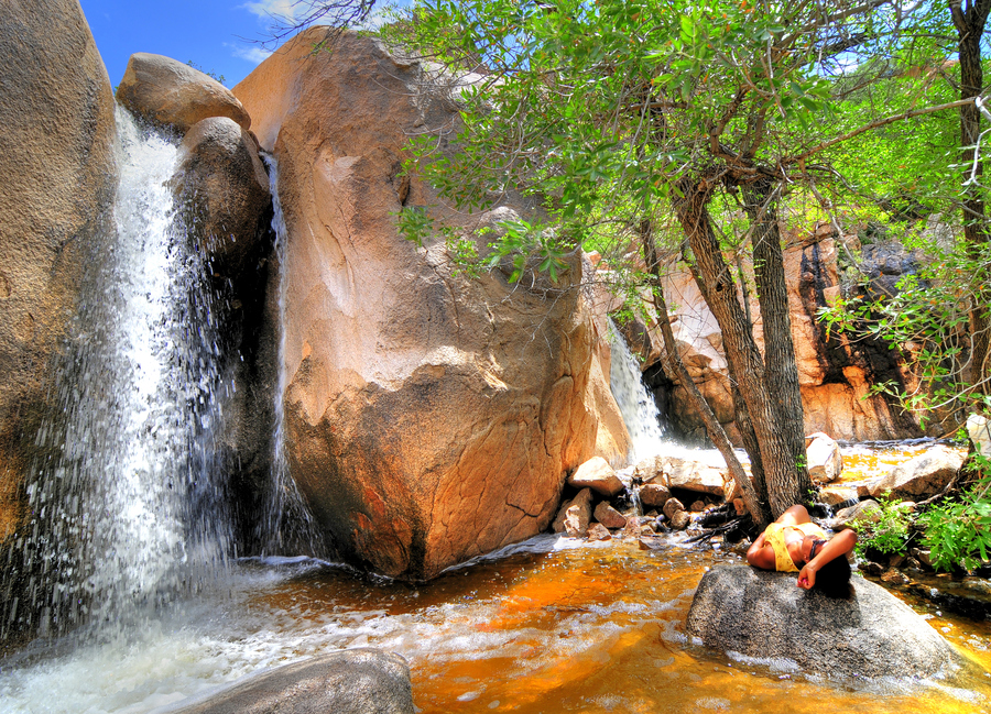
The land gained by the U.S. in the Gadsden Purchase includes part of the Sonoran Desert, the Coronado National Forest, the Chiricahua Mountains, the Dragoon Mountains, and Texas Canyon just to name a few features. The Sky Island mountains are not as formidable as the Rockies or the Cascades but they are high enough to host conifers, broadleaf evergreens, and deciduous trees. Where there are trees there is water. It was a good deal for the U.S.
In Apache it’s called Favorite Place
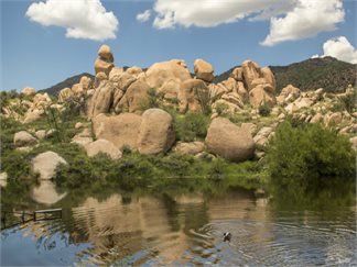
There’s a part of the Dragoon Mountains known as Cochise Stronghold. The term “stronghold” is a military term applied by non-Apaches. To the Apaches it was known as “favorite place”.
The Favorite Place is where there are caves for shelter, shade, fresh water and food to forage and hunt. It’s not too cold or too hot for survival. The heat from the sun brings out the scent of the trees, rocks and water together. It smells like heaven. It was a safe place for hiding and an easy place to defend. The fact that Cochise selected this land for himself and his people would indicate he was using some version of what we currently call Feng Shui and his knowledge was probably passed down to him.
In the land grabbing that followed the Gadsden Purchase, the Apaches, whose tribe had been living in the area probably since the 14th century, were compelled to defend the land and their people against all comers including the U.S. military. Though they may have been at a disadvantage in terms of numbers or weapons, they had Chief Cochise and the land on their side. Nevertheless, in 1872 the Chiricahua Apaches were finally overcome and confined to reservation lands in southeast Arizona. Cochise himself went to the Dragoons to live in his Favorite Place with his people. He was one of the few chiefs who negotiated successfully to get the land and the terms he wanted for his tribe.
In 1874 Cochise died of natural causes, probably stomach cancer, on the reservation. His body is said to have been buried in a hidden place in the Dragoons by his people. The location of his grave has not been found to this day.